
Civic Science Observer
In Michigan, a citizen science project tracking salamander migration is bringing a community together and building a dataset
“The reason that this really works as a science project is a little bit of an accident of geography” – Dr. Jill Leonard
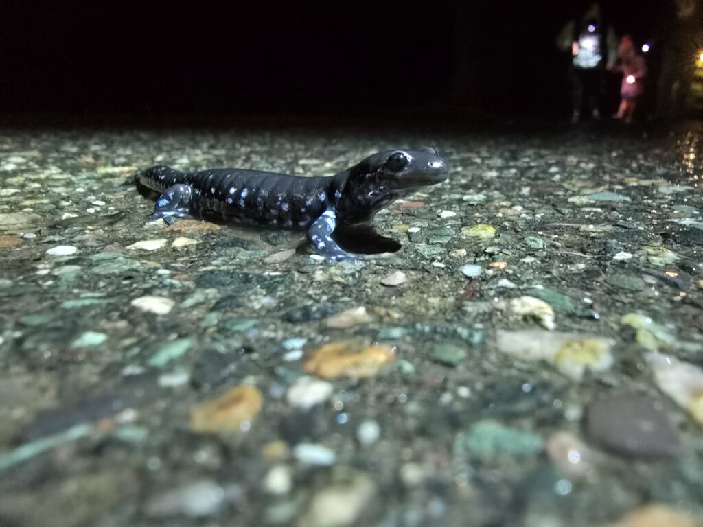
Once a year, like clockwork, hundreds of blue spotted salamanders— Ambystoma laterale — walk from the forests of Presque Isle Park in the Upper Peninsula of Michigan to nearby springtime bogs by the shore of Lake Superior. These bogs offer an ideal location for the salamanders to lay their eggs.
However, to get to the bogs, the salamanders have to cross a road, and cars would hit the salamanders as they crossed. A student at Northern Michigan University—who was also a herpetologist—lobbied the city of Marquette in 2019 to set up a temporary seasonal barrier to protect the salamanders. The city obliged, setting up a barrier from 8 o’clock at night to 8 o’clock in the morning.
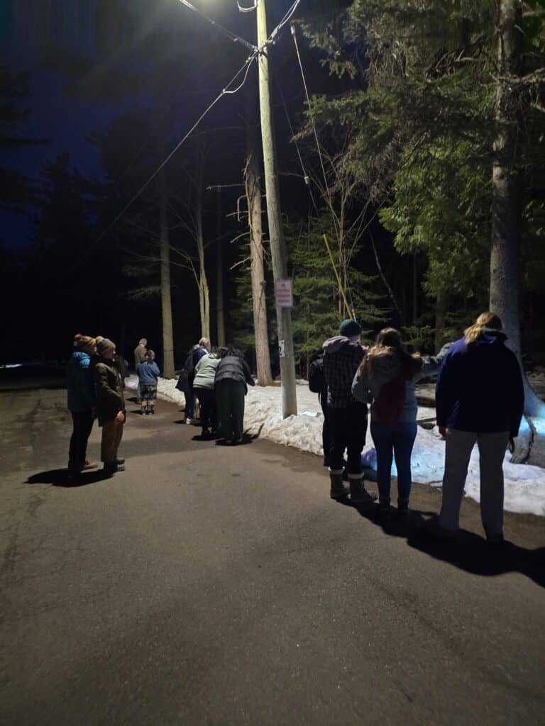
But to everyone’s surprise, the local townspeople started congregating at the road closure to watch the salamanders cross the road.
“What we found is that the community got really into it,” Jill Leonard, department head and professor of biology at Northern Michigan University, told Civic Science Observer. “There’s not that many things to do in the UP in on a rainy night in April because it’s cold, and so people started coming out to see the salamanders.”
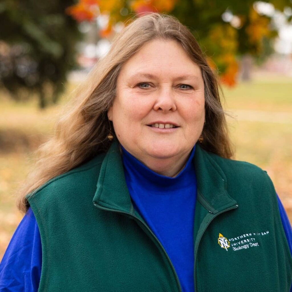
And that’s how the Marquette Salamander Migration Project was born. The townspeople began congregating at the salamander crossing, and Leonard and others determined that there should be human monitors at the salamander crossing to ensure that the salamanders are not stepped on or picked up. Leonard also realized that this situation provided a ripe opportunity for data collection. They started collecting data in 2021.
“The reason that this really works as a science project is a little bit of an accident of geography,” Leonard said. “The island has just this one area of road that they need to cross to get to the boggy area. There are a lot of animals that cross in this one area. And so, it’s been a really nice way to learn about that population.”
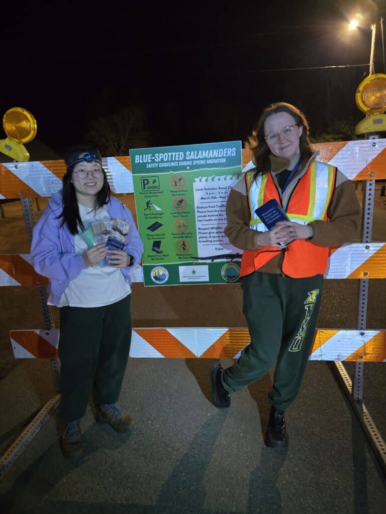
“For four years now, I’ve been training and organizing undergrads to be salamander stewards—now we call them salamander rangers—who collect data,” Leonard said. “I trained 200 students to do this. It’s student-led, and it really is community science. It’s not like these are students who are in my research lab. These are kids on the campus who want to participate, and they want to engage with this conservation project.” The students act as docents for the public, and they count how many salamanders cross the road.
Data collection occurs in the springtime, with the peak happening during the first couple of weeks of April. The data collection includes tracking the salamanders as they walk from Presque Isle Park to a nearby bog on the other side of the road to breed in the ponds. The ponds are on the shore of Lake Superior, although the salamanders don’t actually go into the lake.
Weeks later, the eggs will hatch, and they will be aquatic larvae for as long as two or three months until they’re ready to transform into terrestrial salamanders.
Refining the data collection process
At first, as the students counted the salamanders, the general public was also invited to do so. Leonard and her team initially planned to compare the students’ results against those provided by the local townspeople.
However, Leonard soon realized that the data provided by the townspeople wasn’t good enough. “The public got bored with it, and it was pieces of paper and all that kind of stuff,” Leonard admitted.
Because the data from the townspeople was inconsistent and spotty, Leonard stopped having the general public collect data. However, two events happened that revived the effort to get local citizens involved in data collection.
First, the project partnered with Earth Ranger, a tech venture that uses artificial intelligence to help sustain conservation efforts globally. Through Earth Ranger, the project was able to build an app that students could use to collect data.
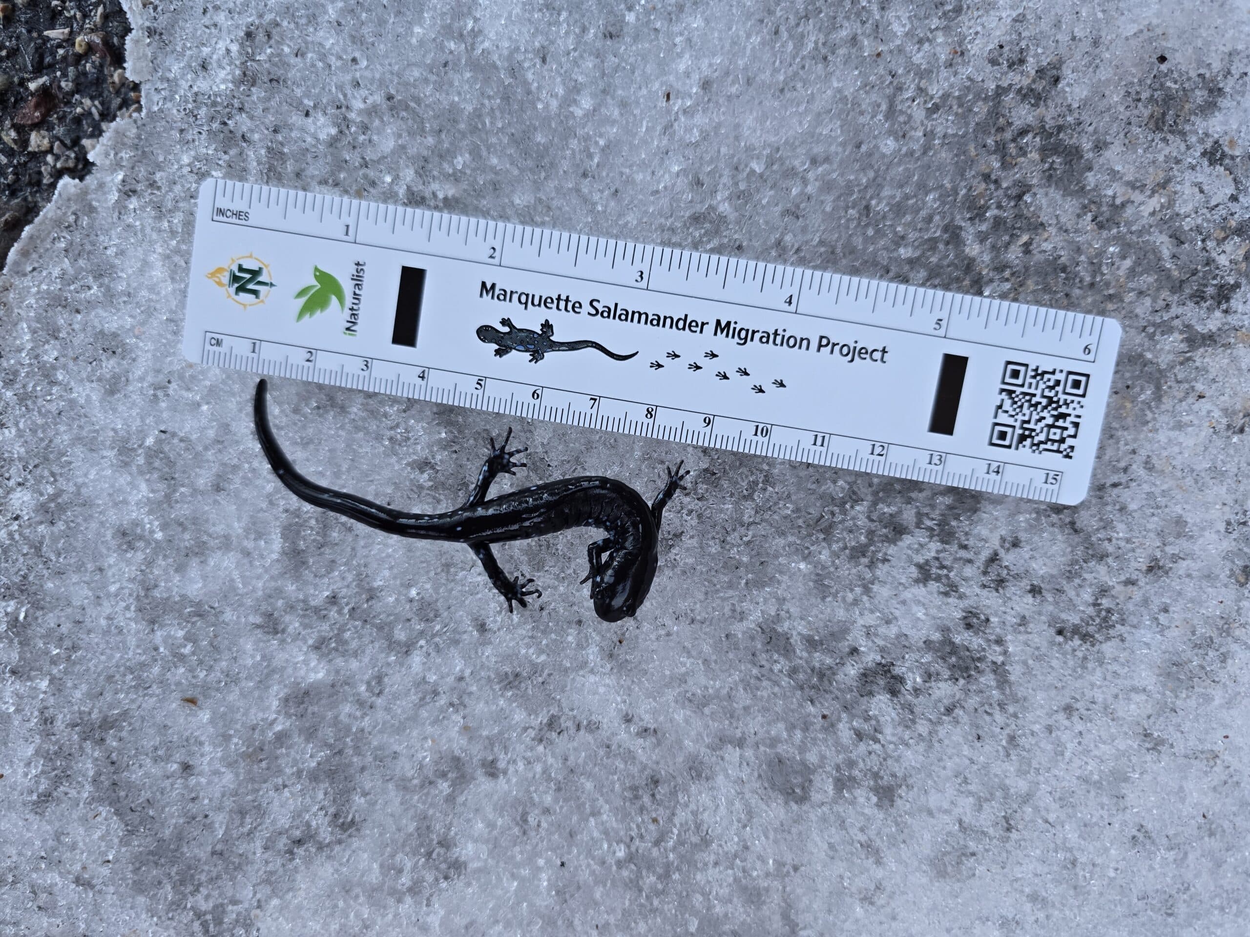
Second, the project developed a ruler that students and the general public could use to measure the salamanders. The project had evolved to include photographs of the salamanders in addition to counting the number of salamanders, and the ruler serves as a way to standardize the measurements of the salamanders.
“It’s not just any ruler. This ruler has the instructions on it—that’s what the QR code is for—and it has these little dark bars which make it photographically standardizable, so however they take the photograph—with different lighting, whether it’s a flashlight or the flash on their phone—we can actually use that photograph to document the length of the animal and look at the morph, the type of salamander that it is,” Leonard said. “We can actually do a fair amount of [analysis] on the information as long as this ruler is in the picture.”
The general public can take a photo using the ruler, and then they can upload the photos to iNaturalist, Leonard continued. The partnership with Earth Ranger also ensures that the data on iNaturalist is preserved and accessible.
Students meanwhile track additional data points, including weather conditions and whether there is precipitation or snow on the ground. Students also undergo training on how to interact with the public.
Both groups upload the data to iNaturalist, and the student scientists can examine the data based on the timestamps.
“I’m hoping I can use the citizen science photographs to get me there,” Leonard said. “The citizens’ photographs will really allow us to be able to look at a large number of individuals over many years.”
The photographs may also help scientists determine the different species of salamanders that cross the road, based on their characteristics of background coloration and size. While the scientists could apply tail clips on some of the salamanders to enable genetics tracking, that kind of effort can be slow and expensive.
Starting this year, data collectors will also count the salamanders when they walk back to the forest after they’ve bred in the ponds and left their eggs there, according to Leonard. “This should help me figure out the timing of when the animals are going toward the spawning area and then they’ leaving,” Leonard said.
This will also be really useful for management, as “it allows us to understand how long the road closure should be,” Leonard continued. “We’re getting to the point where we’re going to be able to model how their environment impacts their migration—that snowfall, snow melt, rain, temperatures—so we can predict when they’re moving on to those kinds of things.”
Other factors that Leonard hopes to explore are the genetic morph of the animal by looking at the timing of the migration. “We’re doing a lot of basic ecology that we couldn’t do before. We’re building this large database that allows us to look at a lot of questions,” Leonard said.
Eventually, Leonard hopes that some of that research will be presented at national herpetology conferences. “The goal is to publish this, as well as to share it with the public and to share it with some of the local conservation folks. For me, as a scientist, I want to get the data out there,” she said.

Joanna Marsh is a freelance writer and journalist based in Washington, D.C. For The Civic Science Observer, she reports on new developments across the citizen science landscape, covering both new research and on-the-ground practice. Her work highlights how local communities are engaging with scientists to contribute to ongoing scientific research and lessons being learned by the involved stakeholders.


In Michigan, a citizen science project tracking salamander migration is bringing a community together and building a dataset

“Science is something that we do together.” Benjamin Richards on how OceanEyes collaborates with citizen scientists to monitor deepwater fish in Hawai’i

Dear Colleagues: Participate in a survey on barriers researchers face when communicating with non-expert audiences

Research!America selects 17 grantees from 132 applicants for the 2026 Civic Engagement Microgrant cohort

Melanie Brown: “If you listen, people want to share things that are important to them.”
Dear Colleagues: Participate in a survey on barriers researchers face when communicating with non-expert audiences

Scott Loarie says conservation science isn’t moving fast enough. He describes how iNaturalist is helping

Photo Essay: 2026 Stand Up for Science New York City

MA3 Challenge awards grants to six universities to modernize promotion and tenure processes: Here’s the question of the day.
Research!America selects 17 grantees from 132 applicants for the 2026 Civic Engagement Microgrant cohort
“Science is something that we do together.” Benjamin Richards on how OceanEyes collaborates with citizen scientists to monitor deepwater fish in Hawai’i
Melanie Brown: “If you listen, people want to share things that are important to them.”

Abby C. King on leveraging local wisdom and science to create a thriving environment: “Our communities are the most valuable renewable resources for a healthy planet.”

Milky Way Project co-creator Grace Wolf-Chase says public engagement is ‘every bit as important as excellent scientific research’

Seeing is believing: Inside the BioBus revenue engine with Ben Dubin-Thaler
Contact
Menu
Designed with WordPress